New litho neutron density tool features shorter length, wireless capability
Aside from the GeoTap IDS, two new tools have been added to the InSite suite of technologies from Halliburton’s Sperry Drilling Services.
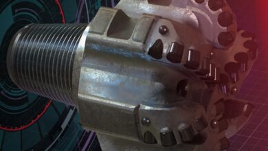
First, the LDN (litho density neutron) is a compensated density and compensated neutron tool in one collar. It incorporates an integral acoustic caliper, and all measurements are azimuthally binned so an image can be created from the density, neutron (density) and the acoustic caliper sensors.
It also boasts a shorter length – at 16 ft compared with the traditional density neutron’s 34 ft or longer. Operators won’t have to drill additional ratholes to take these measurements, said Jim Wilson, Sperry’s principal global champion for MWD/LWD.
The other key feature is that the tool can be read wirelessly. “Rather than having to electronically plug in the tool as done in the past, we’ll be able to read the tool as soon as the antennae clears the surface of the drill floor. The data acquisition time will be faster probably by a factor of 10 to 100 times,” Mr Wilson said.
He expects the tool to undergo field test on US land within the next couple of months.
Also coming into the InSite toolbox is StrataSteer 3D multi-well geosteering service, to be launched later this year. Michael Bittar, director of formation evaluation technology for Halliburton’s drilling and evaluation division, explains that StrataSteer 3D is a workflow in the digital asset. The digital asset is a real-time collaborative environment to model, measure and optimize the oil and gas asset.
“It will allow us to continuously update the Earth model as we are drilling and geosteering the well. We’ll use the InSite ADR and other InSite tools to precisely place the well in the sweet spot of the reservoir,” he said.
The ADR (azimuthal deep resistivity) is a deep-reading device that can measure in 32 sectors around the borehole. It can distinguish whether a change in resistivity is happening above, below or to the side. It also has 14 depths of investigation up to 18 ft so you know how far away the formation change is.
Recently, the ADR was used successfully on a well in the North Sea’s Oseberg area to precisely place a long, horizontal section through the reservoir while avoiding an overlying, unstable formation, according to one presentation at the 2008 SPE Annual Technical Conference & Exhibition, held 21-24 September in Denver, Colo.
In that well, seven resistivity curves were pulsed in real time to the surface: three average resistivity measurements at deep, medium and shallow depths of investigation; four azimuthal resistivity measurements with one deep reading and one shallow reading, each from the up and down octants.
The deepest resistivity measurements had an estimated depth of investigation of 2 m to 2.5 m – which the authors said was ideal because a deeper depth of investigation would not help to geosteer the well through the formation with interbedded sands and silts of 2-3 m thickness. The achieved depth of investigation allowed the sensor to see the upper/lower boundaries of the sands, therefore able to steer between the boundaries.
The StrataSteer 3D was also used in this project to correlate the azimuthal resistivity data against offset well data. This allowed for continuous updates of the geological model based on seismic data, offset data and real-time well data.
SPE 116071, “Maximizing Reservoir Contact in the Oseberg Field Using a New Azimuthal Deep-Reading Technology,” by M Bittar, F Hveding, N Clegg, J Johnston and P Solberg, Halliburton Energy Services, and Gro Mangeroy, StatoilHydro, was presented at the SPE Annual Technical Conference & Exhibition, Denver, Colo., 21-24 September 2008.


